A Look at the Village Today

A Look at the Village Today |
|
 |
 |
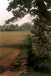
Kirby-le-Soken today still has the feel of a traditional English village, it is isolated from Kirby Cross, Frinton-on-Sea and Walton-on-the-Naze by fields and retains a village shop, two pubs and the Church. This isolation is due to local council policy which ensures developers cannot build on the agricultual land that surrounds the village, it seems almost inevitable however that one day in the future the guard will slip and the village will be engulfed by the growing conurbation that lies beyond. That will be a sad day.
What we see of the village today is a development of the old lower road, Kirby was originally a scattered farming community with an upper and lower road. Many people still refer to the village as lower Kirby with the upper road now known as Kirby Cross. What is now defined as Kirby-le-Soken by the village signs and speed restriction is, in fact, a rather small percentage of the original lands of the five manors of old and one could almost say the village has retreated to the former heartland around the church.
The village can be entered by three routes, from the West or East on the B1034 or from the South by coming down Halstead Road from Kirby Cross. In this brief drive-through we will go from West to East.
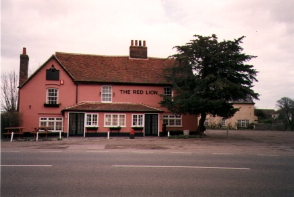
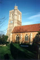
By the time we arrive at the village sign to the West of the village we've already passed two of the old manor houses, Sneating Hall lies behind and right and Birch Hall lies behind and left. The entrance to the village is narrow with the road squeezed by housing close to the road, it then opens out again and we move past the lane leading to Kirby Hall on the right. Immediately after this is the Church on the Right and the Red Lion pub on the left.
 |
 |
After the Red Lion on the left is Maltings Lane and Maltings Cottages. Maltings Lane leads down to the saltings and the backwaters and was the site of a landfill, a compound still exists for the public to take rubbish today, although the rubbish is now taken elsewhere. Maltings Cottages are a conversion of a traditional turned-floor maltings which existed in the early to mid 19th Century. The village shop and post office was at the end of the block but relocated in the 1980s.
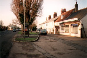
Next by the left of the road is the War Memorial commemorating those from the village that lost their lives during both World Wars, the memorial originally stood at the juction of The Street and Halstead Road but was moved when the juction was re-modelled in the 1950s. After the Memorial and the green upon which it stands we find the garage owned by Graham Oxborrow. The garage stands on the site of the old forge and village smithy and this family business has been in existence since 1837, changing from blacksmiths to automobile and agricultual engineers with the advent of motor transport.
The junction of The Street and Halstead Road marks the centre of the village and the former site of "The Cage". This structure was used by the local policeman to punish offenders by locking them up, exposed to the elements, overnight, the site is remembered by the name of a nearby house, "Cage Corner".
Passing "Low Barn" on the left we come to Street House which was formerly a beerhouse called the "Royal Oak", many public houses brewed their own beer and with a local supply of malt for brewing and thirsty farmhands to drink the finished product it made good sense. The pub stopped brewing in 1900 when it was bought by a local brewery and was later converted to a house.
A little futher on the left, almost hidden from view, is a lane which is a public footpath today and orginally the access to Kirby Quay. After this is the Ship Inn, a public house known as "White Elms" in the 18th Century, the modern car park was once occupied by cottages.
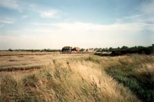
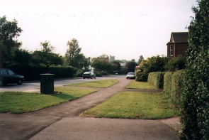
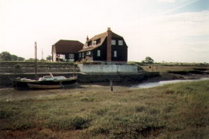
Beyond the modern housing on the left is the entrance to the modern Quay Lane which leads down to Kirby Quay, most visitors to the village today miss this important part of Kirby's History but it is well worth a visit. The modern "Quay House" was actually a Granary until about 1920 and stood alone next to the quay where the barges tied up, grain and coal were regularly transported by barge until the middle of the 19th Century when the railway took over.
Continuing our journey along the main road we pass the village shop and post office on the right and past further housing out of the village. A road further up on the left leads again to the backwaters, specifically The Wade and the causeway to Horsey Island.
So we end our tour on the road to Walton-on-the-Naze with lovely views of the backwaters, the location (with all the names changed) for Arthur Ransome's childrens book "Secret Water".